Playing Worldle
While inside during the pandemic, you may have played a map-based puzzle game called Worldle. Worldle's premise is simple: every day, you are given an outline of a country, and you have six guesses to guess what country it is. For example, what country is this?
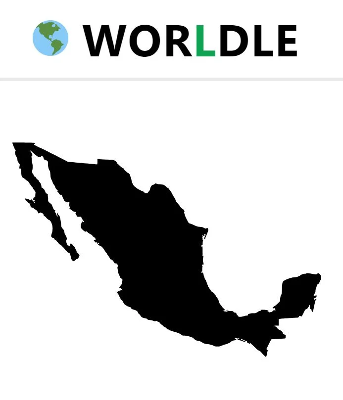
I got this one, no problem. I'm a bit of a geography buff because Dani has a quiz app on her phone that we play while drinking beer at the bar. That's why I was surprised to see a long, skinny country I had never seen before when playing a few weeks ago. Do you know what country this is?
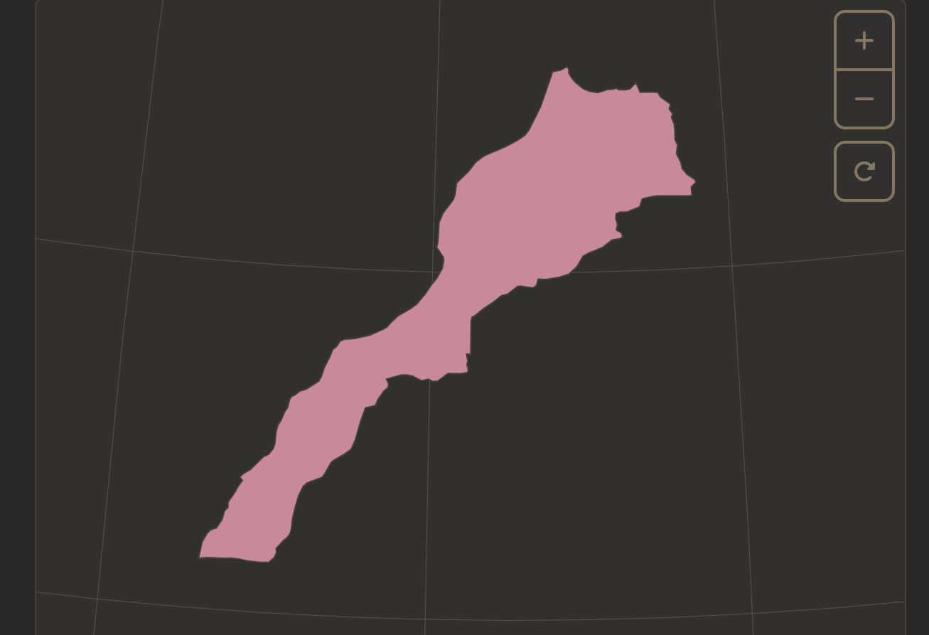
If you guessed Morocco, you would be correct. This answer caught me off guard because when I was twenty, I travelled for three months around Morocco. During that time, I spent a considerable amount of time in and out of gift shops, where I became intimately familiar with the country's boot-like outline emblazoned on bags, shirts, and earrings.
This wasn't the outline on Worldle. Strangely, they had chosen to recognize a portion of Western Sahara, a sparsely populated region claimed by the indigenous Sahrawi people, as part of Morocco, doubling its length. This was a strange editorial decision for a puzzle game, as only two countries currently recognize Moroccan sovereignty over Western Sahara: The United States and Israel. This recognition dates back to 2020, when the United States announced that it would recognize Moroccan sovereignty over Western Sahara in exchange for Morocco normalizing relations with Israel.
I missed the bus and had to walk to work last week. During my walk, I couldn't stop thinking about how strange it was that Worldle made that choice, and I wondered if they had made other controversial cartographic decisions. I was able to find some information on the dataset they used to create their online maps, called Natural Earth, via an outdated version of one of their other games that was still online. It said:
"Natural Earth draws boundaries of sovereign states according to de facto (“in fact”) status rather than de jure (“by law”). We show who actually controls the situation on the ground because it turns out laws vary country to country, and countries are only loosely bound by international law in their dealings with each other. While our de facto policy does not please everyone, it is rigorous and self consistent."
This dataset is a widely used mapping dataset created by The Washington Post. Theoretically, their "de facto" approach to cartography makes some sense. At any given time, there are countless border disputes across the world. These can be minor disputes, like France and Italy, who disagree over the details of much of their Alpen border, including which country the famous peak Mount Blanc is located in (if you scroll into Google Maps you can see diverging dotted lines through the popular tourist destination), or prominent: both the People's Republic of China and the Republic of China (Taiwan) recognize sovereignty over mainland China. "One China" asserts that there is only one de jure Chinese nation, despite the de facto division between the two governments that has existed since the Chinese Civil War.
These "Points of View," as Natural Earth refers to them, create mutually unrecognizable maps. This is a problem that all map makers have to contend with when determining their borders. Recently, for example, Google Maps came under scrutiny for employing a point-of-view approach to this problem, altering borders based on the location from which the map was viewed. This, critics felt, legitimized the hostile actions of authoritarian regimes. Natural Earth believes this also creates confusion for map users: users wouldn't want to travel from point A to point B and realize on arrival that a different power occupied point B than they thought.
De facto maps aren't without controversy either. They favor the occupying presence in any territory, whether that occupation is legal or not. Natural Earth chooses, for example, to display Crimea as an undisputed part of Russia, neutering the outline of Ukraine that we have all become so familiar with into an unrecognizable blob. This prominent example has drawn criticism online for the open-source mapping service. On Github Issues, I scroll past open issues with thousands and thousands of comments, photos of dead bodies, discussions like whether or not the West Bank should now be dotted out to represent the areas occupied by Israeli settlers, and users litigating every moral and legal argument for why Crimea should be a rightful part of Ukraine. The moderators, employees at The Washington Post, are used to the barrage, and calmly use these simple criteria to determine who the occupying force in a region is:
Test 1: Can an "average" citizen from the given Country travel to Region C and exercise the same freedoms as they can in their home country?
Test 2: Can an "average" citizen from Region C travel to the given Country and exercise the same rights as they can in Region C?
Using these tests, they classify Crimea as a de facto part of Russia, despite Ukraine holding a de jure legal claim to it.
Occupation, however, is not as straightforward as you would think. There are plenty of places where the above would be true, but Natural Earth does not consider them stable enough to be considered territories. For example, though Crimea, occupied since 2014, is labeled as part of Russia, Luhansk, Donetsk, Zaporizhzhia, and Kherson are still considered Ukrainian territory, even though they are also technically occupied.
Similarly, Abkhazia and South Ossetia, breakaway states within the nation of Georgia, have been de facto administered by their self-proclaimed republics since 1992 and are recognized as independent states by Russia. Despite this, because they use the Russian ruble as their currency, hold Russian passports for travel abroad, and use Russian telephone numbers, Natural Earth considers them part of Russia. Here is a guide from Wikipedia on the criteria.
| Territory in question | Autonomous Republic of Abkhazia | former South Ossetian Autonomous Oblast |
|---|---|---|
| Claimed by | Georgia (country) (1992–present) |
|
| De-facto administrated by | Abkhazia (1992–present) |
South Ossetia (1992–present) |
| Russia considers it part of its territory? | No, Russia recognises Abkhazia as an independent state[1][2] since 2008 following the Russo-Georgian War | No, Russia recognises South Ossetia as an independent state[3][4] since 2008 following the Russo-Georgian War |
| Nature of occupation | Presence of the 7th Military Base, opposed by Georgia | Presence of the 4th Guards Military Base, opposed by Georgia |
| De-facto armed forces | Abkhazian Armed Forces | Armed Forces of South Ossetia |
| De-facto circulating currency | Russian ruble | |
| Passports | Abkhazian passport. Residents are also eligible for Russian passports for travel abroad. | South Ossetian passport. Residents are also eligible for Russian passports for travel abroad.[5] |
| Under Russian telephone numbering plan? | Yes, +7 (840) and +7 (940) | Yes, +7 (850) and +7 (929) |
Natural Earth's choice here reflects the 1933 Montevideo Convention's declarative theory of statehood which defines a state as a person in international law if it meets the following criteria: 1) a defined territory; 2) a permanent population; 3) a government and 4) a capacity to enter into relations with other states.
Abkhazia and South Ossetia don't quite meet this criteria for statehood. By contrast, Natural Earth considers Somaliland independent, even though it is not commonly internationally recognized because it possesses sufficient self-sustaining infrastructure that Abkhazia and South Ossetia lack. This lack of self-supporting infrastructure is why other occupied areas, like parts of Myanmar, Libya, or Syria, are not regarded as independent states.
The game Worldle hasn't copied Natural Earth verbatim, however. They chose to make a few of their own decisions, editorializing the de facto map into something more palatable for puzzle gamers drinking their morning coffee. For example, they removed Guantanamo Bay from the list of possible countries that could appear on a daily basis. They reunified Ukraine with Crimea. Small islands, such as Réunion, Martinique, Guadeloupe, and French Guiana, are elevated to national status. Thus, Worldle has liberated them from the remains of France's colonial legacy. The Falkland Islands have also finally gained their independence from Great Britain. However, they still retain their colonial name.
What remains after these changes is a map populated with de facto decisions about countries whose boundaries are less clearly understood. On Worldle, all that remains of the Kashmir dispute is the Siachen Glacier, a tiny triangle of unoccupied land squeezed between Pakistan, China and India. The disputed territories of Kashmir are neatly divided up and subsumed into their de facto occupier. Morocco retains Western Sahara, while India maintains Arunachal Pradesh, a region that China claims as part of Tibet. On Worldle, the Golan Heights are part of Israel. I think about Ukraine, its outline so familiar to us now that its shape seems essential to its self-determination. The meaning of these outlines should be more significant to a game that teaches you how to recognize them.